Western Washington's version of Santa Ana winds? Cascadia winds explained

You have undoubtedly heard of the infamous Santa Ana winds in Southern California: the gusty and hot desert breeze that brings on intense heat and severe fire danger to the Los Angeles Basin.
Did you know that we have a similar phenomenon here in western Washington?
In recent years, our gusty mountain breezes have become known as "Cascadia winds."
To understand how such winds form, you first need to understand a basic rule from meteorology 101: in an effort to balance the atmosphere, air will "run away" from high pressure to fill up a low. The deeper an incoming low, the faster that air will "run," and that creates what we know as wind.
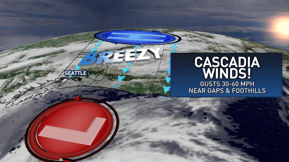
Santa Ana winds start to blow when a big area of high pressure forms over Nevada, sending the air blowing toward lower pressure offshore from Los Angeles. Similarly, we often get a strong ridge of high pressure trapped over eastern Washington.
If a storm, otherwise known as an area of low pressure, starts to approach the Washington coast, the difference in the pressure (the gradient) will create an easterly or "offshore" flow. The wind will start to blow from eastern Washington and out to sea.
However, there is a large bit of terrain standing between the Columbia Basin and the Pacific Ocean: the Cascade mountain range.
The air can't get through the mountains, so it must climb up and over them. Upon doing so, it rushes down the western side, twisting and turning through the passes and gaps in the topography, then rushing out into the valleys and communities immediately below. When air is forced through a constricted space, it speeds up. If you've ever blown through a straw, you'll feel the force of the air coming out the other end as a direct and powerful burst of air. Similarly, the rushing air exiting out of the terrain gaps and into our eastside foothill cities like North Bend, Enumclaw and Gold Bar is moving at a very fast pace once released.
While these communities feel the concentrated force of that bottled up air, cities farther away from the mountains will feel little to nothing at all. A strong round of localized Cascadia winds can result in damaging 40 to 60 mph gusts in places such as Maple Valley or Issaquah, whereas the leaves on the trees won't even flutter near the I-5 corridor in such an event.
For a long time, these wind scenarios went without a name in the Puget Sound. They were sometimes referred to as "offshore" winds or "easterly winds," but those terms came with too many questions from the public.
In meteorology circles, "offshore winds" mean that air is moving from land to sea, but understandably, many viewers thought that meant that the winds were happening offshore, over the Pacific. Similarly, there is a lot of confusion about the term "easterly." We'd get many questions asking, "Does that mean the wind is moving TO the east or FROM the east?"
As such, local meteorologists came up with the term "Cascadia winds" in 2019 so that, like the Santa Anas, the very localized phenomenon would be associated with the foothills at the base of the mountain range from which they are blowing. Increasingly becoming part of the local lexicon, the term "Cascadia winds" now successfully alerts those impacted by these powerful and damaging gusts that downed trees and power outages are likely on the way.