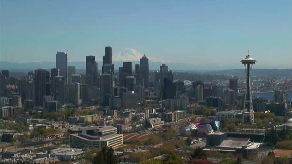
What is a 'thermal trough'?


{sd-embed class="sd-embedded-media" data-embed-file="%3Cdiv%3E%3Cp%3E%0AThe%20thermal%20trough%20is%20responsible%20for%20almost%20all%20of%20our%20heat%20waves%20in%20the%20summertime.%20A%20lot%20of%20times,%20we%20associate%20low%20pressure%20with%20stormy,%20rainy%20weather.%20%20But%20intense%20heat%20can%20also%20cause%20low%20pressure.%0A%3Cp%3E%0AIn%20the%20hot%20desert,%20you%20have%20a%20lot%20of%20warm%20air%20rising%20into%20the%20upper%20atmosphere.%20%20That%20creates%20lower%20pressure%20near%20the%20ground%20as%20you%20now%20have%20less%20air%20around.%20%0A%3Cp%3E%0AThis%20is%20a%20near-daily%20occurrence%20in%20the%20summer%20in%20the%20Desert%20Southwest%20and%20California.%20%20However,%20if%20strong%20high%20pressure%20moves%20south%20out%20of%20Canada%20and%20into%20the%20Rocky%20Mountain%20states,%20that%20can%20actually%20push%20the%20thermal%20trough%20north%20into%20the%20Pacific%20Northwest.%0A%3Cp%3E%0AAt%20this%20point,%20the%20placement%20of%20the%20trough%20is%20key%20to%20the%20temperatures%20around%20the%20area.%20In%20some%20sense,%20it%20might%20be%20best%20to%20think%20of%20the%20trough%20as%20a%20valley,%20and%20air%20will%20want%20to%20pour%20into%20the%20valley%20to%20fill%20it.%0A%3Cbr%3E%0A<>%3Ctable%20border=%220%22%20cellpadding=%220%22%20cellspacing=%220%22%20style=%22border-collapse:%20collapse%22%20bordercolor=%22#111111%22%20width=%22100%25%22%3E%0A%20%20%3Ctr%3E%0A%20%20%20%20%3Ctd%20width=%2250%25%22%3E%3Cimg%20border=%220%22%20src=%22http://komonews.s3.amazonaws.com/Thermal_trough_01.jpg%22%3E%3C/td%3E%0A%20%20%20%20%3Ctd%20width=%2250%25%22%3E%0A%20%20%20%20%3Cimg%20border=%220%22%20src=%22http://komonews.s3.amazonaws.com/Thermal_trough_02.jpg%22%20align=%22left%22%3E%3C/td%3E%0A%20%20%3C/tr%3E%0A%3C/table%3E%0A%3Cp%3E%0AA%20few%20times%20a%20year,%20the%20trough%20will%20actually%20come%20north%20either%20along%20the%20Pacific%20Coastline%20or%20even%20out%20over%20the%20ocean.%20%20When%20that%20happens%20and%20the%20trough%20is%20to%20our%20west,%20you%20have%20air%20now%20rushing%20from%20the%20east%20out%20toward%20the%20offshore%20trough%20(See%20" %3ca%20href="%22/weather/faq/4307517.html%22%3EWhat%20Is%20Offshore%20Flow%3C/a%3E"%20for%20more%20information%20there.).%20That%20offshore%20flow%20will%20bring%20us%20very%20warm%20temperatures%20--%20probably%20some%20of%20the%20warmest%20of%20the%20season.%0A%3Cp%3E%0AThe%20trough%20can%20stay%20offshore%20for%20a%20few%20days,%20bring%20an%20extended%20heat%20wave%20to%20the%20area.%20%20But%20eventually,%20the%20predominant%20westerly%20flow%20will%20win%20the%20battle,%20pushing%20the%20trough%20east%20into%20Eastern%20Washington%20and%20beyond.%0A%3Cp%3E%0AAs%20the%20trough%20pushes%20east%20of%20your%20location,%20the%20winds%20will%20shift%20from%20east%20to%20west,%20bring%20a%20rush%20of%20cooler,%20ocean%20air%20into%20the%20region,%20most%20likely%20triggering%20a%20marine%20push%20(See%20"%3Ca%20href=%22/weather/faq/4306832.html%22%3EWhat%20Is%20A%20Marine%20Push?%3C/a%3E"%20%0Afor%20more%20information%20there.)%20and%20bringing%20an%20abrupt%20end%20to%20the%20heat%20spell.%0A%3Cp%3E%0AFor%20Seattle,%20the%20fun%20begins%20as%20soon%20as%20the%20trough%20passes%20over%20the%20Cascade%20%0Amountain%20range.%0A%3Cp%3E%0A(You%22ve%20heard%20the%20saying,%20"The%20bigger%20they%20are,%20the%20harder%20the%20fall."%20Usually,%20the%20stronger%20the%20thermal%20trough,%20the%20greater%20the%20cooling.%20It%22s%20not%20unusual%20to%20have%20one%20day%20where%20it%20is%2093%20degrees%20outside,%20have%20the%20trough%20move%20east,%20and%20then%20have%20the%20next%20day%20be%20about%2067%20degrees%20under%20a%20heavy%20fog.)%0A%3Cp%3E%0A%3Cb%3EDo%20It%20Yourself%20Forecasting%20/%20Other%20Notes%3C/b%3E%0A%3Cp%3E%0AThermal%20troughs%20are%20some%20of%20the%20most%20interesting%20weather%20patterns%20to%20track,%20because%20you%20can%20watch%20its%20movement%20in%20real-time,%20and%20the%20pattern%20follows%20a%20general%20script.%0A%3Cp%3E%0AIn%20troughs%20that%20begin%20offshore,%20you%20can%20track%20their%20eventual%20demise%20by%20%0A%3Cspan%20lang=%22en-us%22%3El%3C/span%3Eooking%20at%20local%20weather%20observations%3Cspan%20lang=%22en-us%22%3E:%3C/span%3E%20(%3Ca%20href=%22http://www.atmos.washington.edu/data/WA_obs.html%22%3EWashingto%3Cspan%20lang=%22en-us%22%3En%20%0ACurrents%3C/span%3E%3C/a%3E%20--%20%0A%3Ca%20href=%22http://www.wrh.noaa.gov/cgi-bin/Portland/afd?PDXSWROR%22%3EOrego%3Cspan%20lang=%22en-us%22%3En%20%0ACurrents%3C/span%3E%3C/a%3E)%20and%20a%0A%3Ca%20href=%22http://www.atmos.washington.edu/cgi-bin/latest.cgi?vis1km%22%3Evisible%20%0Asatellite%3C/a%3E.%20%20%0A%3Cp%3E%0AUsually,%20on%20the%20visible%20satellite,%20you%20can%20see%20fog%20moving%20north%20from%20the%20California%20Coast%20into%20Oregon%20as%20the%20trough%20moves%20north%20and%20east%20of%20those%20areas,%20thus%20bringing%20the%20cool%20ocean%20breeze%20behind%20it.%0A%3Cp%3E%0AYou%20can%20also%20keep%20tabs%20on%20the%20Oregon%20and%20Washington%20Coast%20cities%22%20current%20temperature.%20As%20the%20trough%20passes%20each%20city,%20the%20temperature%20will%20take%20a%20huge%20drop%20(usually%20into%20the%20upper%2050s%20or%20mid%2060s),%20the%20wind%20will%20shift%20to%20a%20west/southwest%20direction,%20and%20the%20fog%20will%20roll%20in.%0A%3Cbr%3E%0A%3Ctable%20border=%220%22%20cellpadding=%220%22%20cellspacing=%220%22%20style=%22border-collapse:%20collapse%22%20bordercolor=%22#111111%22%20width=%22100%25%22%3E%0A%20%20%3Ctr%3E%0A%20%20%20%20%3Ctd%20width=%2250%25%22%3E%3Cimg%20border=%220%22%20src=%22http://komonews.s3.amazonaws.com/Thermal_trough_03.jpg%22%3E%3C/td%3E%0A%20%20%20%20%3Ctd%20width=%2250%25%22%3E%3Cimg%20border=%220%22%20src=%22http://komonews.s3.amazonaws.com/Thermal_trough_04.jpg%22%3E%3C/td%3E%0A%20%20%3C/tr%3E%0A%3C/table%3E%0A%3Cp%3E%0AAs%20it%20comes%20up%20the%20Oregon%20Coast,%20that%22s%20a%201%20day%20warning%20that%20the%20heat%20wave%20is%20coming%20to%20an%20end%20for%20the%20Washington%20Coast,%20and%20a%202-2.5%20day%20warning%20that%20the%20end%20of%20the%20heat%20wave%20is%20coming%20to%20Seattle.%0A%3Cp%3E%0ABy%20the%20next%20day,%20the%20trough%20has%20probably%20moved%20over%20the%20Puget%20Sound%20area,%20and%20%0Athe%20fog%20line%20usually%20has%20moved%20up%20to%20the%20tip%20of%20the%20Washington%20Coast,%20keeping%20%0Athem%20in%20the%20mid%2060s%20while%20Seattle%20bakes%20in%20the%2085-95%20degree%20range.%20%3Cbr%3E%0A%3Ctable%20border=%220%22%20cellpadding=%220%22%20cellspacing=%220%22%20style=%22border-collapse:%20collapse%22%20bordercolor=%22#111111%22%20width=%22100%25%22%3E%0A%20%20%3Ctr%3E%0A%20%20%20%20%3Ctd%20width=%22100%25%22%3E%0A%20%20%20%20%3Cp%20align=%22center%22%3E%3Cimg%20border=%220%22%20src=%22http://komonews.s3.amazonaws.com/Thermal_trough_05.jpg%22%3E%3C/td%3E%0A%20%20%3C/tr%3E%0A%3C/table%3E%0A%3Cp%3E%0AThe%20day%20the%20trough%20moves%20overhead%20is%20usually%20the%20warmest%20day%20of%20the%20heat%20wave%20%0A(and%20you%20can%20also%20watch%20the%20trough%20pass%20Port%20Angeles%20as%20their%20winds%20shift%20from%20%0Aeast%20to%20west%20and%20their%20temperature%20will%20plummet.)%0A%3Cp%3E%0AAs%20soon%20as%20the%20trough%20passes%20over%20the%20Cascades,%20the%20rush%20of%20cool%20(refreshing?)%20marine%20air%20will%20rush%20into%20the%20Puget%20Sound%20area.%20%20This%20normally%20happens%20around%2010%20p.m.%20to%20midnight,%20but%20can%20happen%20anytime.%20You%20can%20usually%20sense%20it.%20%20The%20wind%20shifts%20from%20north%20to%20south,%20and%20you%20can%20begin%20to%20hear%20the%20wind%20chimes%20going%20and%20puffs%20of%20cool%20air%20move%20in.%0A%3Cbr%3E%0A%3Ctable%20border=%220%22%20cellpadding=%220%22%20cellspacing=%220%22%20style=%22border-collapse:%20collapse%22%20bordercolor=%22#111111%22%20width=%22100%25%22%3E%0A%20%20%3Ctr%3E%0A%20%20%20%20%3Ctd%20width=%22100%25%22%3E%0A%20%20%20%20%3Cp%20align=%22center%22%3E%3Cimg%20border=%220%22%20src=%22http://komonews.s3.amazonaws.com/Thermal_trough_06.jpg%22%3E%3C/td%3E%0A%20%20%3C/tr%3E%0A%3C/table%3E%0A%3Cp%3E%0AIt%20is%20something%20that%20boaters%20need%20to%20watch%20carefully.%20If%20we%20get%20a%20very%20strong%20push,%20winds%20can%20go%20from%20calm%20to%2035-40%20mph%20winds%20in%20a%20real%20hurry%20--%20especially%20in%20the%20Strait%20of%20Juan%20de%20Fuca%20and%20Northern%20Inland%20waters.%0A%3Cp%3E%0A%3Cb%3EFor%20More%20Information:%3C/b%3E%0A%3Cp%3E%0A%3Ca%20href=%22/weather/faq/4307517.html%22%3EWhat%20Is%20Offshore%20Flow%20%3C/a%3E%0A%3Cbr%3E%0A%3Ca%20href=%22/weather/faq/4306832.html%22%3EWhat%20Is%20Onshore%20Flow/Marine%20Push%20%3C/a%3E%3C/div%3E" "="" data-embed-type="code" id="ui-id-73" }<="" sd-embed="">